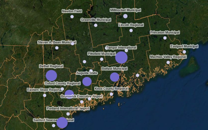
Interactive Airport Map
Visual aid for finding airports and projects
The Dynamic Analysis Tool - Statewide System Planning is a centralized hub and document control system with built-in workflows for managing projects, grants, financials, and funding transfer data across your statewide airport system.
CIP Funding Request and Management. Project summaries provide a high-level view of all airport projects costs and funding, and the status of approvals. CIP funding requests can be generated and routed through the system for approval. Authorized staff can then adjust project funding, allowing operations to maintain, and manage airport projects, and instantly see the impact of those changes.
Grant Management. Built into our Statewide System Planning tool is a full Grant Management System that provides application and financial checklists to help ensure State and FAA reports and document requirements are filed on-time.
Your staff, airport sponsors, and consultants can stay informed with the ability to receive notifications within the system or via email.
Understanding the sensitivity of financial data, we built in role-based permission settings for modifying data by your airports' staff and consultants. Utilizing a full 3D GIS map, you can click on an airport and quickly view the airport's attributes.
Integrate this tool with our Dynamic Analysis Tool for additional financial analysis and scenario-based forecasting.
This application is a proprietary software program of McFarland-Johnson, Inc., and protected under U.S. Patent No. 9,189,824.
Request More Information Data Sheet
Visual aid for finding airports and projects
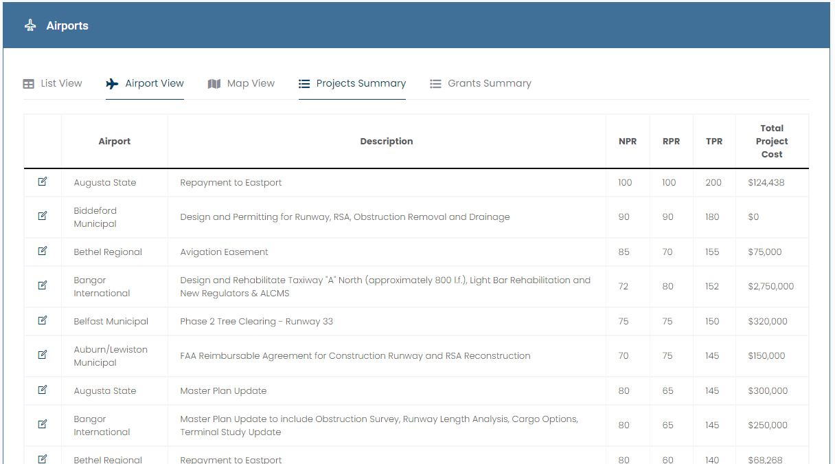
Manage projects on a statewide or airport-specific level
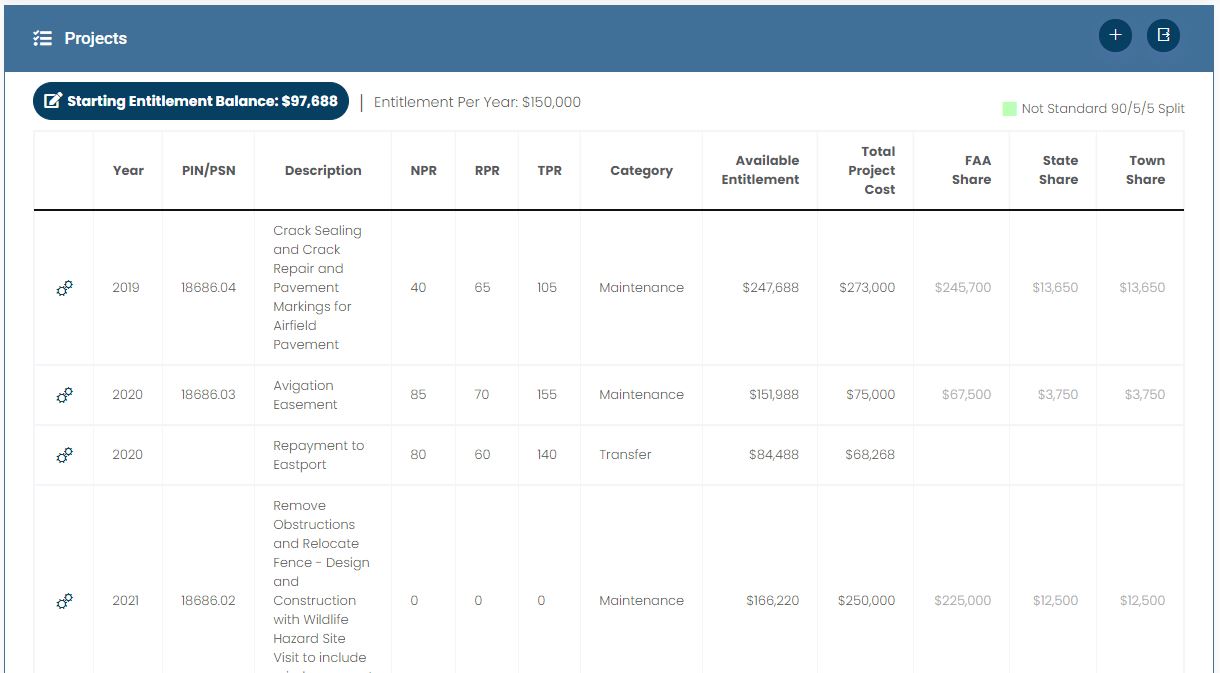
View upcoming projects and adjust available entitlements
All of our solutions require web browser access and conform to the latest modern standards. It is necessary to use a browser that is compatible with these standards so that all functionality can be ensured. InfraSolutions strongly suggests the use of the Google Chrome browser, but you can find a list of all supported browsers in the grid below.


