 Meet AVA – Your AVIAS Virtual Assistant
RUMBLE™ Overview
Product Update
Introducing AVIAS™ 2.0
AVIAS™ 2.0 delivers a modernized airport management platform built for multi-airport operations, faster spatial workflows, and configurable decision support across planning, inspection, land use, and capital programming.
Version 2.0
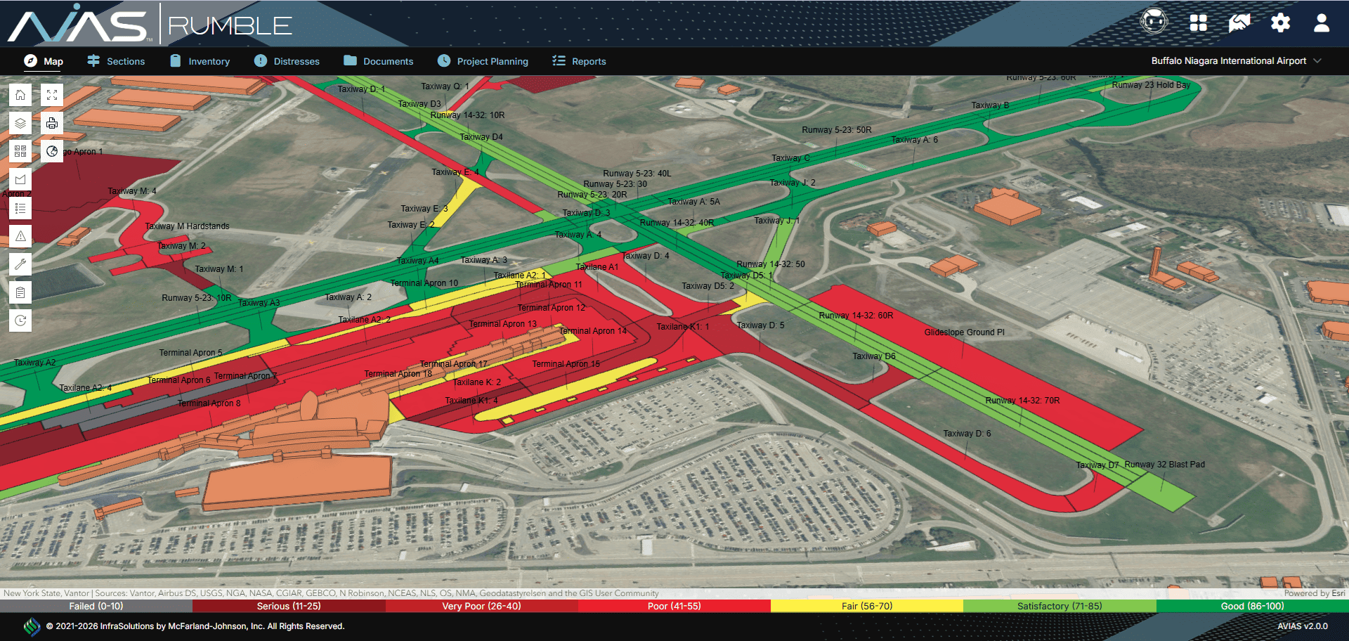
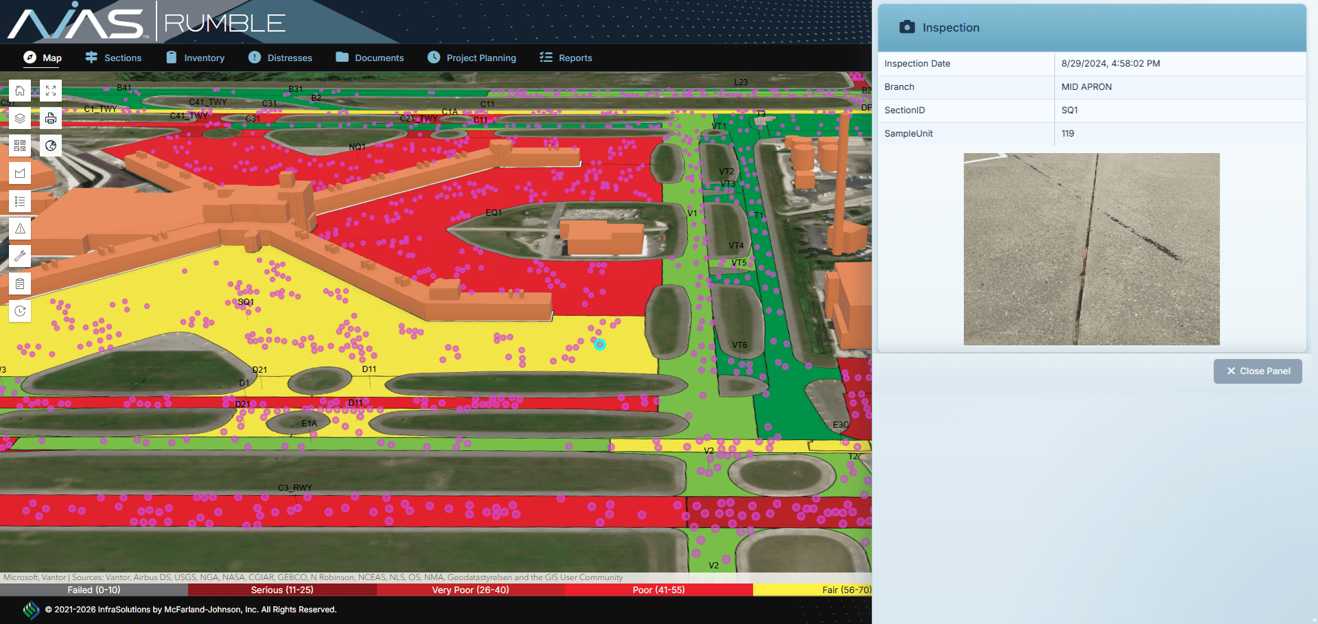
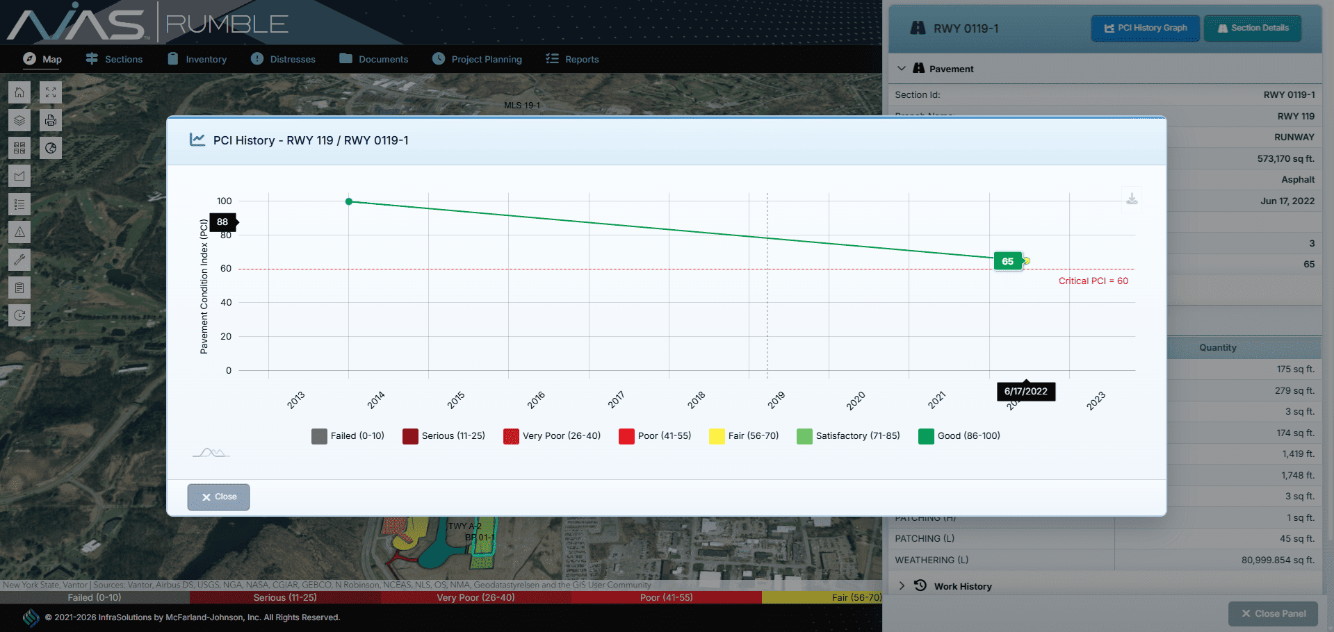
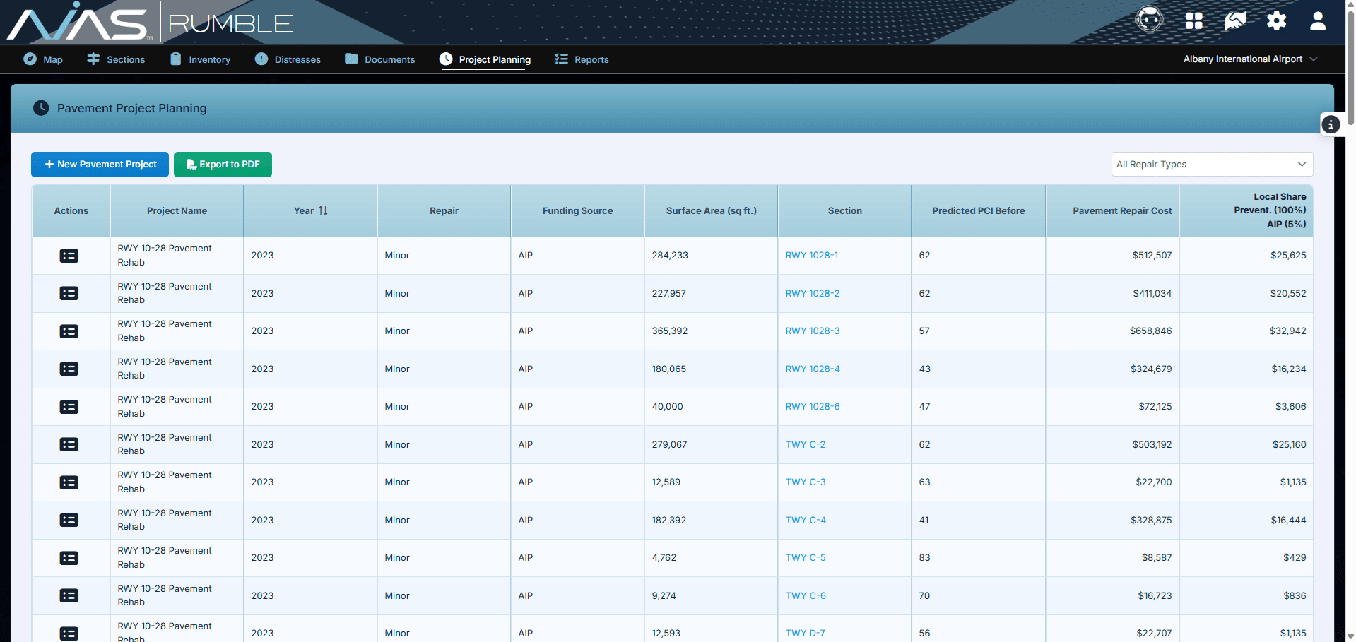
RUMBLE™ - Pavement Management
The AVIAS™ RUMBLE™ Pavement Management application combines the GIS portion of an interactive map with data MJ collects to conduct timely and cost saving pavement studies. The unique ability to toggle individual pavement sections at your airport allows your staff instant access to current and historical information on deterioration rates, pavement conditions, distresses associated with the pavement, work history, notes, and any related photographs or attachments relevant to the related pavement section.
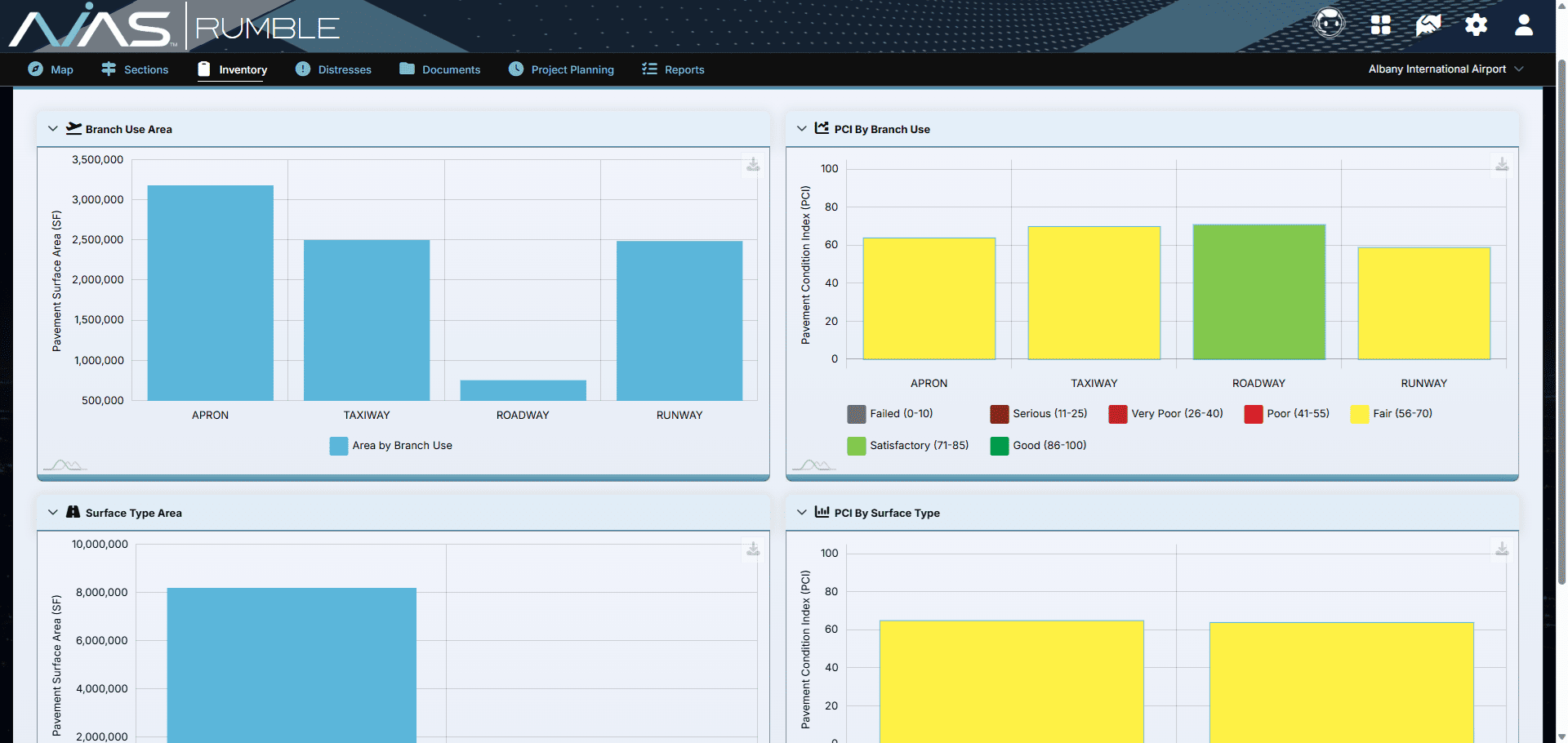
RUMBLE™ has a customizable pavement inventory of runway, surface area, taxiways, and aprons and will display the current, as well as historical Pavement Condition Index Value data. With the provided data, airport staff will optimize their short- and long-term capital planning initiatives.
This is made easier with our Project Planning feature, built so your airport management can add, remove, and prioritize projects in the years and dates they see fit. The project planning feature breaks down costs by square foot for preventative, minor, moderate, and major projects and can compare repair costs by time if not completed.
RUMBLE™ has the ability to adjust for inflation rates, so your team will have access to the current costs associated with your project.
This application is a proprietary software program of McFarland-Johnson, Inc., and protected under U.S. Patent No. 9,189,824.
Technical Specifications

Cloud-Based
Access anytime, anywhere with no on-premise installation required

Reliable & Scalable
Hosted on Amazon AWS for security, performance, and uptime

Cross-Browser Compatible
Works on all modern web browsers—no setup required

Secure & Encrypted
Protected with HTTPS for safe and reliable data transmission

Robust Storage
Backed by Amazon S3 for scalable and durable data management

Powered by ESRI
Proven GIS technology for mapping and spatial analysis


×
![]()
×
![]()
×
![]()
×
![]()
×
![]()