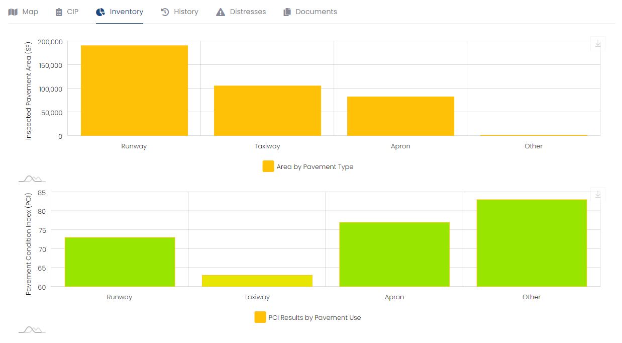
Display Pavement Information in Useful Charts
Quickly summarize the state of your airport's pavement
The Dynamic Analysis Tool - Pavement Management combines a GIS interactive map with data collected from a pavement study. Our tool features a customizable pavement inventory of runway, surface area, taxiways, and aprons and will display the current, as well as historical PCI value data.
With pavement data centralized, airport staff can optimize your airport's short- and long-term capital planning initiatives. This is made easier with our Project Planning feature, allowing your airport management to add, remove, and prioritize projects by year and dates to make the best use of funding.
The Pavement Management tool has the ability to adjust costs for inflation rates, allowing your team to more accurately predict the associated costs of delaying projects. The project planning feature breaks down costs by square foot for preventative, minor, moderate, and major projects and can compare repair costs over time to assist in planning.
The unique ability to toggle individual pavement sections at your airport allows your staff instant access to current and historical information on deterioration rates, pavement conditions, distresses associated with the pavement, work history, notes, and any related photographs or attachments relevant to the related pavement section.
Request More Information Data Sheet
Quickly summarize the state of your airport's pavement

Find section-specific information like distresses and work history

Manage associated files and images
InfraSolutions has been involved with establishing individual programs for airport clients of all sizes, as well as establishing and updating statewide system programs. Our personnel have experience in every phase of the Pavement Management System program, including the population of databases with critical baseline information such as existing pavement structures, maintenance histories, and traffic data. We have experienced pavement field inspectors that can identify the types and extent of pavement deterioration present, and translate that information into a standard Pavement Conditions Index (PCI) for programming purposes. We have experience using computer programs such as the FAA's Micro-PAVER to populate databases, present current conditions, predict future conditions, and establish schedules for updates. We can also expand this information to include economic analysis and program budgeting, a critical component in establishing cost-effective programs to address the rehabilitation of airfield pavements.
All of our solutions require web browser access and conform to the latest modern standards. It is necessary to use a browser that is compatible with these standards so that all functionality can be ensured. InfraSolutions strongly suggests the use of the Google Chrome browser, but you can find a list of all supported browsers in the grid below.


